
Products / Metrovista™
Metrovista™
The CityMapper from Leica has enabled Bluesky to capture several UK cities in a way that has never been achieved before. The Leica CityMapper is the world’s first hybrid airborne sensor combining oblique and nadir imaging as well as a LiDAR system into one sensor. Bringing together the best of both worlds, the CityMapper is specifically designed for urban mapping. Combined with the high-performance post-processing workflow, it offers a complete 3D urban mapping solution.
Products available:
Metrovista™ Mesh
These automatically created mesh models are fully rendered using the vertical and oblique photography, making them a cost-effective alternative to traditional 3D models.
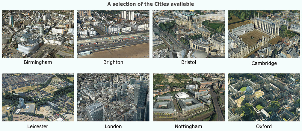
Locations: Birmingham, Bournemouth, Brighton, Bristol, Cambridge, Derby, Doncaster, Eastbourne, Leicester, London, Manchester, Newcastle, Norwich, Nottingham & Oxford.
Formats: OBJ, FBX, SLPK
Software: You will need specialist software to open Metrovista™ Mesh.
- For OBJ / FBX: AutoCAD, Maya (other software is available)
- Open source software can be used to view the data: e.g. CloudCompare, MeshLab
Please note: Metrovista™ Mesh is individually processed by our expert delivery team. We aim to deliver within 2 working days, via an email download.
MetroVista™ Ortho - 2.5cm
Ultra high-res digital aerial photography is available for selected cities across England, captured using our Leica CityMapper camera.
MetroVista™ Ortho - 5cm
Super high-res digital aerial photography is available for selected cities across England, captured using our Leica CityMapper camera.